#20
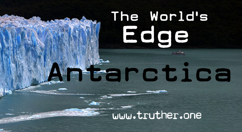
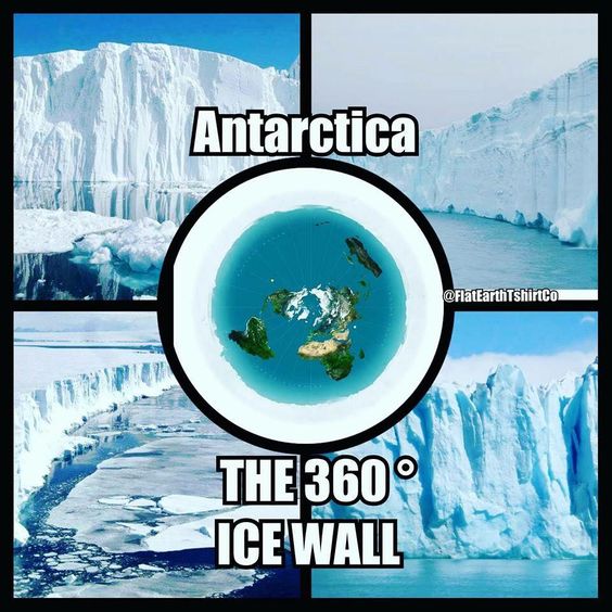
Antarctica is the rim of the Earth, a great ice barrier. The first explorers met with a massive ice wall between 1000 and 2000 feet thick, rising above the water 100 to 200 feet. Sir James Clark Ross was confronted with a sheer cliff of ice perfectly level on top that he estimated 200 feet high, extending east and west as far as the eye could see.
The Challenger expedition of 1872–1876 made many discoveries to lay the foundation of oceanography. They named the journey after the naval vessel that undertook the trip, HMS Challenger, which sailed close to Antarctica.
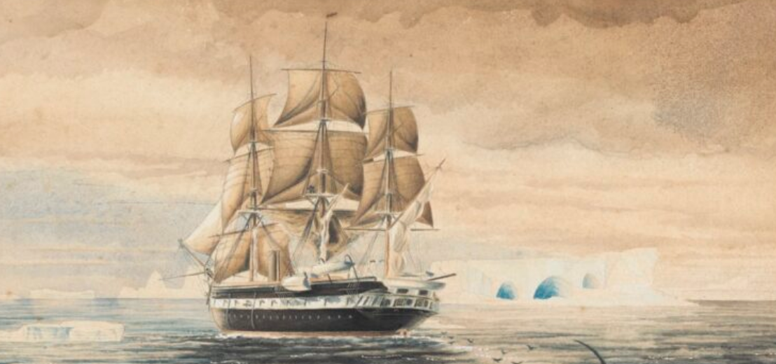
“The result of the Challenger’s prolonged cruise did not do much to raise their expectations, for she did not discover a passage to the supposed other side of the world, through the ice-bound waters of the South.”
The approximate circumference of Antarctica is supposed to be 14.460 statute miles on a globe model. However, the Challenger spent three years and traversed nearly 69000 nautical miles (130,000 km). That distance would have allowed the ship to circle Antarctica over four times if the Earth were a globe. A flat-Earth perfectly explains the 69.000-mile-long journey around the circumference of the Earth.
Voyage to the South (Southern Latitude 78 degree)
Vasco de Gama remarks:
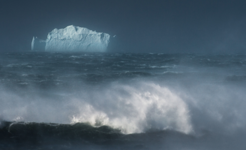
“The waves rose like mountains in height; ships are heaved up to the clouds and precipitated to the bed of the ocean. The winds are piercing cold and so boisterous that the pilots’ voice can be scarcely heard, while dismal and almost continual darkness adds greatly to the danger.”
Antarctic Voyages
Captain Sir James Clark Ross writes:
“The sea quickly rising to a fearful height, breaking over the loftiest bergs. Our ships were enveloped in an ocean of rolling fragments of ice, as hard as floating rocks of granite, which were dashing against them with so much violence that their masts quivered as if they would fall at every successive blow. The rudders were destroyed and nearly torn from their stern posts. The hour passed away after hour without the least mitigation of the awful circumstances in which we were placed.”
Exploring Expedition
Commander Wilkes, the USA writes:
“The general health of the crew is decidedly affected. A few more days of such exposure as they have already undergone would reduce the number of the crew by sickness to such an extent as to hazard the safety of the ships, and the loss of all on board.”
Arctic Explorations
W. & R. Chambers
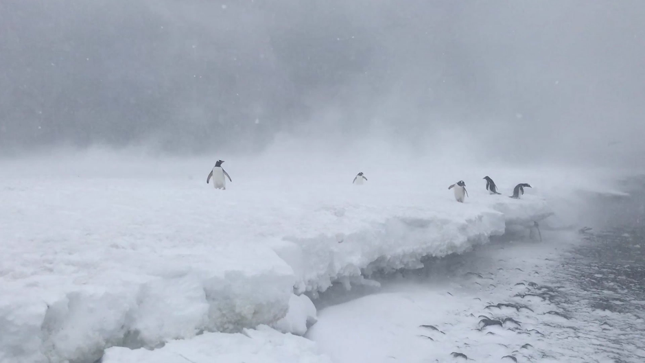
“Beyond the 70th degree of Southern Latitude, not a tree meets the eye, wearied with a white waste of snow; forests, woods, even shrubs have disappeared and given place to a few lichens and creeping woody plants, which scantily clothes the indurated soil. Still, in the farthest North, nature claims her birthright of beauty; and in the brief and rapid summer, she brings forth numerous flowers and grasses to bloom for a few days.”
Such scenes of desolation are unknown in the northern regions, in the same degrees of Latitude. In the Arctic, there is spring and summer.
Wrangell:
“Countless herds of reindeer, elks, black bears, foxes, sable, and grey squirrels fill the upland forests. Stone foxes and wolves roam over the low ground; enormous flights of swans, geese, and ducks arrive in spring and seek deserts where they may molt and build their nest in safety. Eagles gulls and owls pursue their prey along the sea coast: and when the Sun shines in spring, one may sometimes even hear the cheerful note of the finch, and in autumn that of the thrush.”
There is a vast difference in the same number of Latitude between the Arctic and Antarctic regions regarding life and vegetation. If the Earth were a globe, it would have been the same climate. Why is so much difference?
“The constant sunlight of the North furnishes subsistence for millions of living creatures. But in the South, where the sunlight never dwells or lingers about a central region, but rapidly sweeps over sea and land, to complete in 24 hours the great circle of the southern circumference, it has no time to excite and stimulate the surface, and, therefore, in comparatively low southern latitudes, everything wears an aspect of desolation.”
Source: David Wardlaw Scott: Terra Firma
France: Latitude: 47°, Longitude 2°
Kerguelen Island(Desolate Islands): Latitude -49° Longitutde 69°
“It is a well-known and indisputable fact that there is a far greater accumulation of ice south of the equator than is to be found at an equal latitude North: and it is said that at Kerguelen, 50 degrees south, 18 kinds of plants exist, while, in Iceland, 15 degrees nearer the northern center, there are 870 species; and, indeed, all the facts in the case show that the Sun’s power is less intense at places in the southern region than it is in corresponding latitudes north.” —WM. Carpenter: 100 Proofs #52
William Swainson, an Englishmen who emigrated to New Zealand, wrote:
“There is not the twilight (in New Zealand, 42 degrees Southern Latitude) you get in England (52 degrees Northern Latitude). Here is still light till about eight ‘o clock. Then, in a few minutes, it becomes too dark to see anything, and the change comes over in almost no time.” —David Wardlaw Scott: Terra Firma
In Northern Europe, twilights last a couple of hours in the summer evenings. In New Zealand, the Sun moves much faster, but a day and a night are still 24 hours.
Midnight sun
The Midnight sun phenomenon is not experienced anywhere in the Southern hemisphere at any time of year. During most of the Antarctic winter, the Sun sets on may 17th and is not seen above the horizon until July 21. This is entirely at odds with the ball-earth theory but easily explained by the flat-Earth model (reality). The midnight sun is seen in extreme Northern latitudes during Arctic summer. At its inner-most cycle, the Sun is circling tightly enough around the polar center that it remains visible above the horizon. In extreme southern latitudes during Arctic summer, the Sun completely disappears from view for two months, and Antarctica becomes dark as night. There is no such other place on Earth like that. —Eric Dubay:Flat Earth Conspiracy
Six months day and six months night
“If the Earth were a globe, there would, very likely, be (for nobody knows) six months day and six months night at the arctic and for their antarctic regions, as astronomers dare to assert there is:—for their theory demands it! But, as this fact —the six months day and six months night —is nowhere found but in the arctic regions, it agrees perfectly with everything else that we know about the Earth as a plane, and, whilst it overthrows the “accepted theory,” it furnishes a striking proof that Earth is not a globe.” —WM. Carpenter: 100 Proofs #37
Circumnavigation is not proof of globularity
“A ship can’t circumnavigate the Earth from South to North or from North to South. Saling must be either from East to West or from West to East. Such circular sailing does not prove that the Earth is a globe. Sailing around the world in principle is the same as that of a yachtsman circumnavigating the Isle of Wight. Let me give a simple illustration. It is like when a boy plays with his boat in a basin. He puts a soap dish in the middle representing the Earth; the water around is the ocean. He leads his boat round his little world. But the ship never passes over the rim to sail under the basin, as if that were globular, instead of simply circular. So is it in the world of ours; we can sail from East to West, or from West to East, but we cannot sail from South to North for we can not break through the impenetrable ramparts of ice rocks which enclose the Great Southern Circumference. Hobart is in the Latitude called by Geographers 40 degree S., and if we sail thence in a southward direction, our voyage will at last stopped by impassable barriers of ice.” —David Wardlaw Scott: Terra Firma
During the colonial period (16th-19th centuries), Britain became a peak power due to its advanced navigation. They used a flat earth map, a compass and observed the stars for positioning. After the invention of the marine-grade watch, they were also able to determine longitudes with perfect accuracy, i.e., how far they were from East or West of England. That’s why it starts there at 0 degrees longitude (prime meridian), in Greenwich. They could accurately determine the Latitudes much earlier by observing the declination of the north star.
Plane sailing is navigating a ship making all calculations assuming that the Earth is flat and has worked fine in both theory and practice for thousands of years.
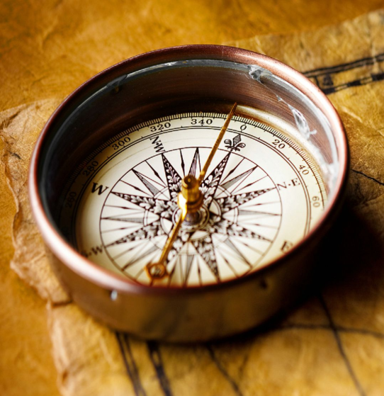
“The needle of this most important instrument (compass) is straight, its two ends pointing North and South at the same time; consequently, the meridians must be straight lines also; whereas on the globe, they are semi-circles. Even at the Equator, the needle points straight, which would be impossible, were that the mid-way of a vast convex globe, as, in such case, the one end would dip towards the North, and the other end is pointed towards the sky. Again, when the navigator goes to sea, he takes his observations and relies on the compass to guide him. He does not provide himself the globe’s model, which, if the world were a globe, would surely be the safest plan for him to adopt, but he takes flat maps or charts. Thus, in practice, he sails his ship as if the sea were horizontal.” —David Wardlaw Scott: Terra Firma
- “That the mariners’ compass points north and south at the same time is a fact as indisputable as that two and two make four; but that this would be impossible if the thing were placed on a globe with “north” and “south” at the center of opposite hemispheres is a fact that does not figure in the school-books, though very easily seen: and it requires no lengthy train of reasoning to bring out of it a pointed proof that the Earth is not a globe.” —WM. Carpenter: 100 Proofs #10
- “As the mariners’ compass points north and south at one time, and as the North, to which it is attracted, is that part of the Earth situate where the North Star is in the zenith, it follows that there is no south” point” or ‘pole” but that, while the center is North, a vast circumference must be South in its whole extent. This is proof that the Earth is not a globe.” —WM. Carpenter: 100 Proofs #11
- “As we have seen that there is, really, no south point (or pole) but an infinity of points forming, together, a vast circumference— the boundary of the known world, with its battlements of icebergs which bid defiance to man’s onward course in a southerly direction— so there can be no east or west ” points,'” just as there is no ” yesterday,” and no “to-morrow.” In fact, as there is one point that is fixed (the North), it is impossible for any other point to be fixed likewise. East and west are, therefore, merely directions at right angles with a north and south line: and as the south point of the compass shifts round to all parts of the circular boundary (as it may be carried around the central North), so the directions east and west, crossing this line, continued, form a circle, at any latitude. A westerly circumnavigation, therefore, is a going round with the North Star continually on the right hand, and an easterly circumnavigation is performed only when the reverse condition of things is maintained, the North Star being on the left hand as the journey is made. These facts, taken together, form a beautiful proof that the Earth is not a globe.” —WM. Carpenter: 100 Proofs #12

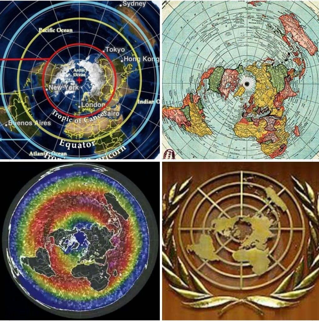
Polar azimuthal equidistant map
According to the United States Geological Survey (USGS), azimuthal maps are accurate in displaying continents and oceans, and pilots and captains use them for air and sea navigation.
Emergency landings are evidence of a flat Earth
On October 7, 2015, a Chinese Airlines flight made an emergency landing in Alaska. They flew from Taiwan to California. The pilot decided to divert the flight to Anchorage Airport six hours after taking off. The emergency landing in Alaska would make a little sense if the Earth were a globe.
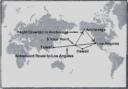
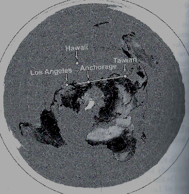
Source: Edvard Hendrie: The Greatest Lie on Earth (p 127)
Flight routes reveals the flat Earth
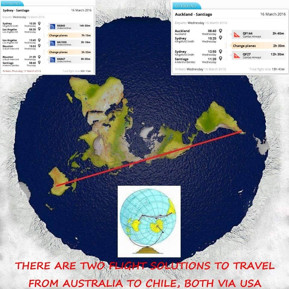
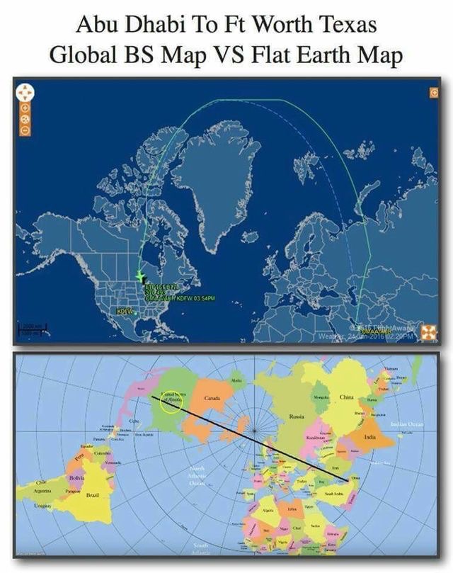
The Globe maps are all wrong
The globe maps are not accurate. No flights or ships would find their destinations using the maps we learned in school. Pilots’ charts are different. The size of the countries does not match reality. If you want to see how the Earth looks like, check out a flat earth map.
“True size” dot com also reveals the fake reality people believe. https://thetruesize.com Australia might be twice as large in reality compared to its size on globe Earth maps. That continent has five time zones which unveil its enormous size.
Antarctic Treaty
Twelve nations signed the Antarctic Treaty (December 1, 1959), an agreement in which the Antarctic continent was made a demilitarized zone to be preserved for scientific research. The Treaty resulted from a conference in Washington, D.C., attended by Argentina, Australia, Belgium, Britain, Chile, France, Japan, New Zealand, Norway, South Africa, the United States, and the Soviet Union. Later other nations acceded to the Treaty.
Source: https://www.britannica.com/event/Antarctic-Treaty
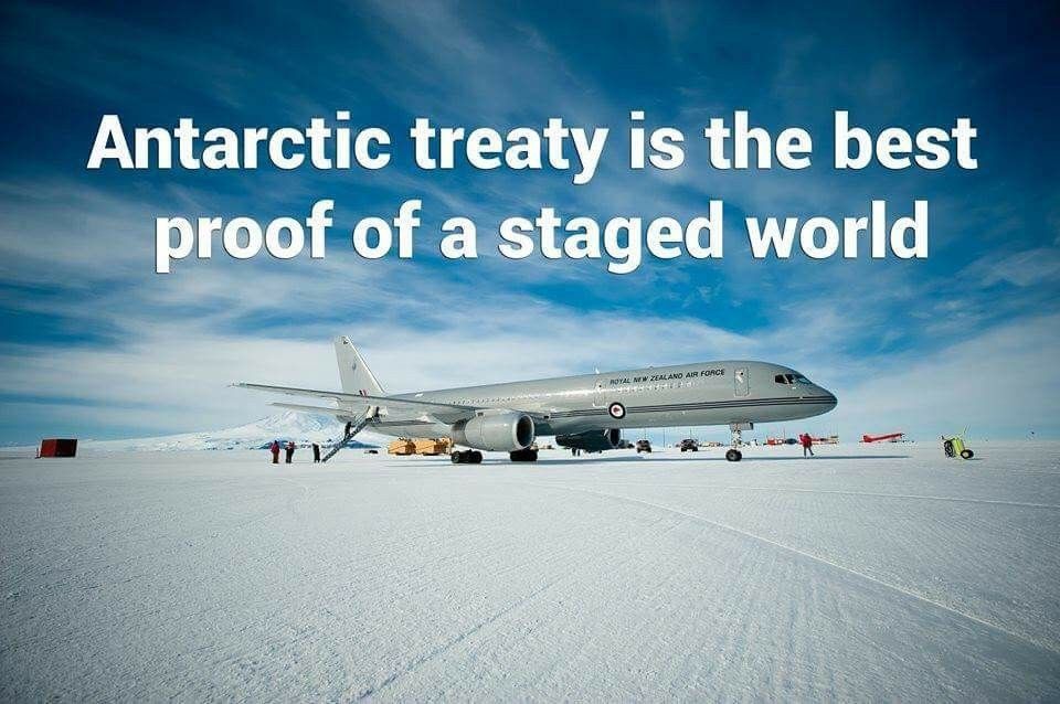
This Treaty is protecting the Area south from -60 degrees latitude. This is the only place on Earth that no superpower wants to exploit. Why? Because maybe they found something there, if that would be known to the public, the flat Earth’s reality was to be revealed, and the position of the elite governing the world would also be shaken.
They must keep the people ignorant of the flat Earth to hide the Existence of the Creator. If the people knew the Earth’s real shape, they would see that it results from intelligent design/Creation. The most striking facts are that there are perfect descriptions in the Bible of how the Earth looks like, which matches reality. I came to this conclusion after several years of research.
The media/science/education system indoctrinates the people to believe that they are just monkeys(animals) living on a spinning ball. There is no consequence of sins; there is no Creator.
In the worldview of the Bible, the Earth is flat. If people realized that the Bible is true, many would read the Scriptures and follow God’s designated path. We would live in a completely different world; there would be far less crime, war, and greed.